National
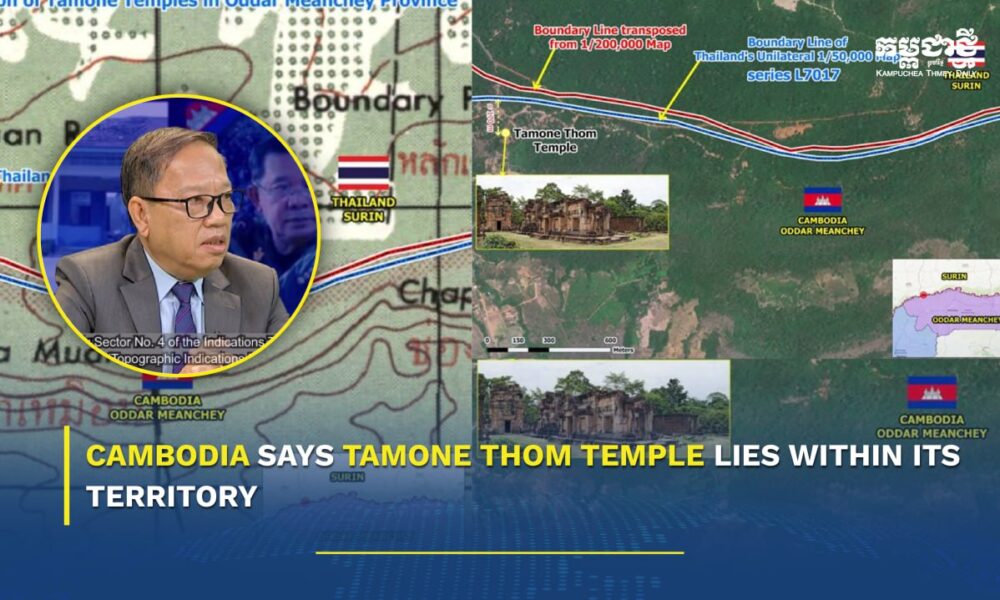
Cambodia says Tamone Thom Temple lies within its territory
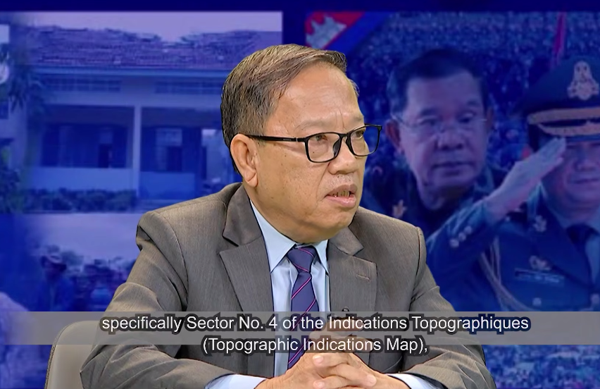
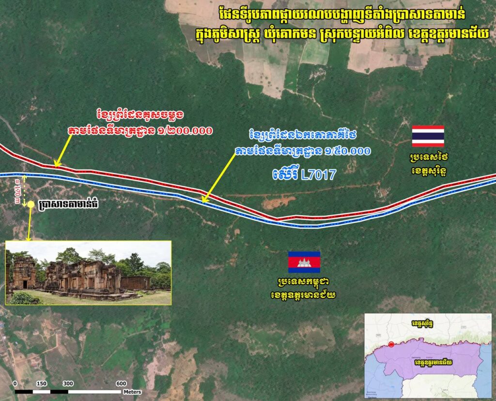
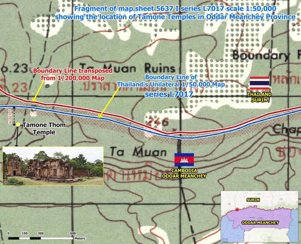
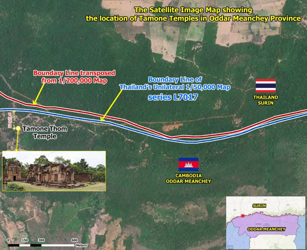
PHNOM PENH, July 8, 2026 (KPT) – Cambodia’s State Secretariat of Border Affairs (SSBA) has said historical boundary documents and mapping records confirm that Tamone Thom Temple is located inside Cambodian territory, noting that even a unilateral map drawn by Thailand places the site on the Cambodian side of the border.
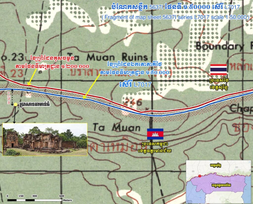
Ith Sotha, Permanent Secretary of State at the SSBA, cited the 1:200,000‑scale map, the 1908 and 1919 boundary‑marking minutes of the Franco‑Indochina–Siam Boundary Commission, and Thailand’s own L7017 map produced at a scale of 1:50,000 as evidence supporting Cambodia’s claim.
He said that when the boundary line from the 1:200,000‑scale map was transferred onto later topographic maps, including Thailand’s L7017, the temple continued to appear within Cambodian territory.
Sotha argued that Thailand’s unilateral mapping and demarcation of the area around Tamone Thom Temple were inaccurate.
“We can examine the topographic map attached to the survey records of the Franco‑Indochina–Siam Boundary Commission from 1908. The document clearly shows that Tamone Thom Temple is located within Cambodian territory,” he said, adding that the historical records provide documentary evidence of Cambodia’s sovereignty over the site.
He noted that the 1:200,000‑scale map and related topographic documents were jointly prepared by French and Siamese authorities during the 1908 border demarcation process and remain key references in Cambodia’s position on the temple’s location.







-
 Opinion1 month ago
From Connectivity to Resilience: How Japan’s Strategic Shift Could Transform Cambodia’s Next Development Phase
-

 Opinion2 months ago
Op-Ed: A Decade of Dialogue, Yet Many Challenges Remain
-
 Economy1 month ago
Cambodia Welcomes 1 Million Tourists in Q1, But Arrivals Fall Sharply Amid Regional Pressures
-
 Economy2 months ago
Cambodia Air Cargo Surges 36% Despite Dip in Passenger Traffic
-
 National4 weeks ago
Samdech Techo Hun Sen Says Cambodia Can Meet Defence Needs Through Domestic Production
-
 Education2 months ago
Cambodia Launches Nationwide Live Teaching Program to Narrow Education Gap
-
 Economy2 months ago
Cambodia’s Special Economic Zones Post Strong Export Growth in Early 2026
-

 Economy2 months ago
Cambodia Stock Exchange Seen as Key to Financing Growth